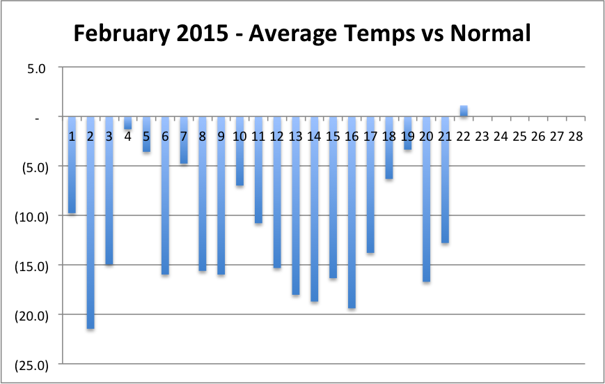
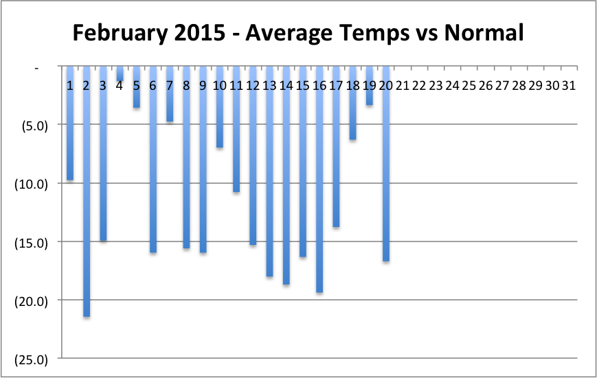
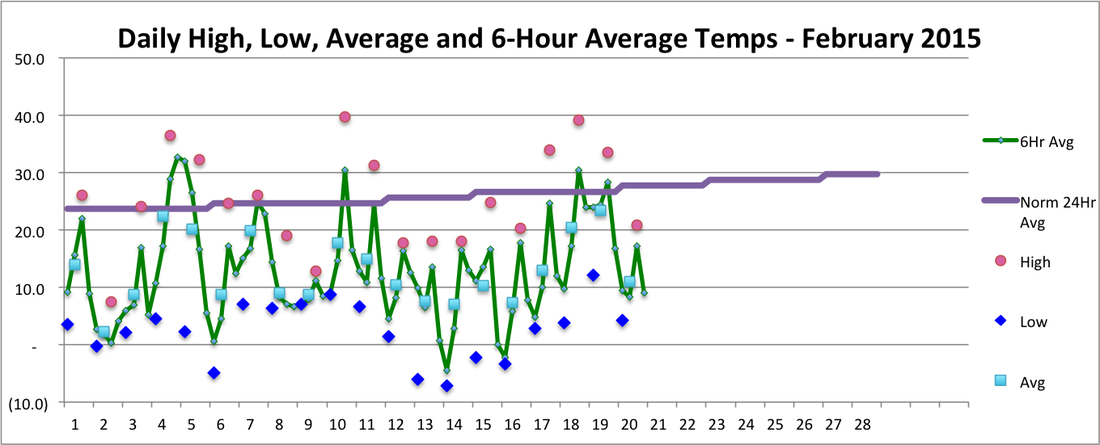
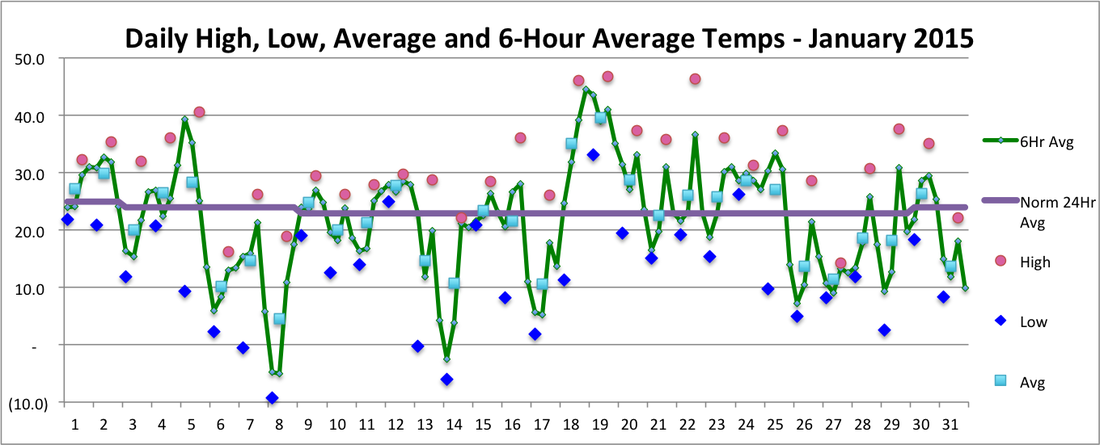
Yes, we finally had a warmer than normal day in Harpswell yesterday. Not by much though and it still looks like this will be the last warm day this month. After reaching 40 yesterday afternoon for the first time since January 22nd, temps dropped fast during the evening and made it closer to normal than the forecast predicted.
Ok, I'll admit, the title was just to try to attract readers, but the weather sure has been on a cold and snowy streak here in Maine! The first graph shows we have yet to have an above normal day, temperature-wise, so far this month. That streak started on the 31st of January and will continue through today, the 21st, for a total of 23 consecutive days. In the previous 50 months that I have been keeping track, we never had more than 12 consecutive days colder than normal. If the forecast holds, tomorrow will end that streak by being a few degrees above normal. After that, the forecast is for more much-colder-than-normal temps for the remainder of the month. We'll see.
Through today, we will have had 14 out of 21 days in February that were at least 10 degrees colder than normal. The forecast says we will have at least a few more of those. Previously in my records, we had never had more than 9 days in a month that were 10 or more degrees colder than normal (March 2014). So far, February has averaged 12.5 degrees below normal. None of the last 50 months have been more than 5.3 degrees below normal (again, March 2014). That will be way off the scale of my latest graph (through January) of monthly temperatures vs normal. Yes, it has been cold. How cold? Well, the second graph shows that the 19th was the first day this month when the low temperature (the blue diamond) was above 10 degrees. Another streak gone. In Portland, where NOAA has been keeping track of temperatures since 1941, it looks like this will be the coldest February ever recorded. The record low February is an average temperature of 15.6 in 1979. Through the 20th, Portland is averaging 12.9 and average temps are unlikely to change that much through the 28th based on the current forecast. We have also had a long streak of snowy weather. Since January 24th, we have not gone more than two consecutive days without snow. As I write this, it is still snowing, but we have at least 3" today. That brings our total since January 24th to 67" in 28 days. This streak also appears to be about to end. The 7-day forecast is for no snow after tonight. Wow! Amazing weather. For only the 3rd time in 49 months, average temperatures were below the 1951-1980 normal temperature. Six days were more than 10 degrees below normal, including the 31st, and February is off to a very cold start as well.
We had 22" of snow on the 27th from Winter Storm Juno, the 4th largest snowfall in one day on record in Portland. Total snow for the month was 42", and 34" of that fell during the week of the 24th to 30th. Up until then, we hadn't had our driveway plowed since Thanksgiving (our association plows our driveways only when there are 4" or more of snow from a storm). Following up on my post about the Harpswell differential, January once again had warmer temperatures in Harpswell than in Portland (by about 0.4 degrees, still smaller than average for January). Most importantly, we have passed Plus One Day, to great celebration in my household! The purple line in the 3rd graph below shows that the normal average temperature rose by 1 degree off the winter floor on the 29th. Normal temps will keep rising now until early August. Of course, that is climate; meanwhile we have to deal with weather, which doesn't look like it will provide anything like normal temps for at least a week. |
SOURCEWeather statistics are based on 5-minute readings at an Ambient Weather station near Mill Cove off of upper Harpswell Sound. Archives
December 2015
Categories |